EDSA
's information is

EDSA

Birth and death years unknown

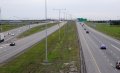
Epifanio de los Santos Avenue, commonly referred to by its acronym EDSA (Tagalog: [ˈʔɛd.sɐ]), is a major circumferential road around Metro Manila, Philippines. It passes through 6 of Metro Manila's 17 local government units or cities, namely, from north to south, Caloocan, Quezon City, San Juan, Mandaluyong, Makati, and Pasay. Named after academic Epifanio de los Santos, the section of the road fr

* Calculated from Wikipedia data.
Accuracy is not guaranteed.


C-4
Epifanio de los Santos Avenue
EDSA
Map of highways in Metro Manila with EDSA highlighted in red.
EDSA-Reliance, Ortigas view (Mandaluyong; 03-21-2021).jpg
EDSA in Mandaluyong, with Ortigas Center in the background
Route information
Part of AH26
Maintained by the Department of Public Works and Highways, Philippine Reclamation Authority, and Metropolitan Manila Development Authority
Length23.8 km (14.8 mi)
Including extension in Bay City, Pasay
Existed1940–present
Component
highways
RestrictionsNo heavy trucks, tricycles
Major junctions
Beltway around Manila
North end AH 26 (N1) (Bonifacio Monument Circle) in Caloocan
Major intersections
South endSM Mall of Asia Globe Rotunda in Bay City, Pasay
Location
CountryPhilippines
Major citiesCaloocan, Makati, Mandaluyong, Pasay, Quezon City, San Juan
Highway system
  • Roads in the Philippines
Look up "EDSA" on Wikipedia

Comments About "EDSA"

Loading...